
Digital Ocean Systems
Pacific Benthic Monitor: Digital Twins, Underwater Modeling & Habitat Surveillance
The Pacific Benthic Monitor couples streaming sensor telemetry with high-performance WebGPU geospatial rendering. By synthesizing regional oceanographic observatories into dynamic digital twins, the platform models underwater acoustics, coastal hydrodynamic currents, and benthic ecosystem health to protect endangered marine habitats and aquaculture operations.
Biomimetic Coastal & Bathymetric Digital Twin Simulations
Understanding subsea dynamics requires moving beyond static 2D nautical charts. The monitor builds high-resolution 3D bathymetric digital twins by interpolating multibeam sonar surveys, Canadian Hydrographic Service soundings, and satellite-derived coastal LiDAR into continuous triangular meshes.
Running natively on client-side WebGPU compute pipelines, the digital twin simulates hydrodynamic boundary layers, tidal current velocity shears, and estuarine freshwater plumes in real time. Operators can observe how bathymetric features like submarine ridges, fjords, and sills deflect currents and influence localized oxygenation.
Underwater Modeling & Acoustic Propagation
Underwater acoustic energy travels four times faster than in air and is heavily shaped by temperature, salinity, and depth stratification. The platform incorporates underwater acoustic modeling based on parabolic equation ray-tracing algorithms:
- Sound Speed Profiles (SSP): Computes depth-resolved acoustic velocity from real-time conductivity, temperature, and depth (CTD) sensor casts.
- Vessel Noise Footprint Mapping: Evaluates low-frequency commercial shipping noise propagation across critical fjord habitats, identifying acoustic shadow zones where marine life is sheltered from disturbance.
- Bioacoustic Event Detection: Analyzes continuous hydrophone streams to detect marine mammal vocalizations (such as resident Orca pods) and distinguish anthropogenic noise spikes.
Endangered Habitat & Marine Health Surveillance
The Pacific Northwest shelters unique, fragile benthic ecosystems that are globally rare and highly sensitive to environmental stressors:
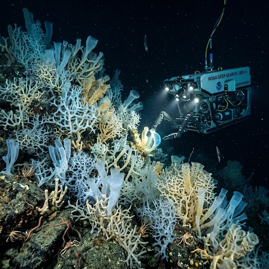
- Glass Sponge Reef Protection: Prehistoric Hexactinellid reefs in Hecate Strait and the Strait of Georgia are vulnerable to sediment plumes from bottom trawling and dredging. The system continuously tracks turbidity, bottom currents, and dissolved silica saturation.
- Eelgrass Meadow Health: Subsea light attenuation models evaluate photosynthetic active radiation (PAR) reaching nearshore Zostera marina beds, providing early warning for meadow die-back.
- Wild Salmonid Migratory Corridors: Monitors thermal barriers and surface warm-water lenses in coastal straits, alerting fisheries managers when water temperatures exceed physiological stress limits for returning wild salmon.
Live Coastal Observatories & Sensor Streams
The monitor aggregates and harmonizes heterogeneous streaming telemetry from regional ocean observation infrastructures:
- Ocean Networks Canada (ONC): VENUS coastal cabled observatory nodes providing high-frequency multi-depth CTD, dissolved oxygen, and acoustic hydrophone logs in Saanich Inlet and the Strait of Georgia.
- Hakai Institute: Coastal oceanographic buoy arrays tracking surface seawater temperature, salinity, fluorometry, and chlorophyll-A along the central and northern coast of Vancouver Island.
- Fisheries and Oceans Canada (DFO): Hydrographic Service SINE water level gauges and Canadian Shellfish Sanitation Program (CSSP) biotoxin monitoring stations.
Predictive Pathogen & Water Quality Dashboards
The system translates complex raw oceanographic parameters into actionable operational alerts for aquaculture growers and coastal operators:
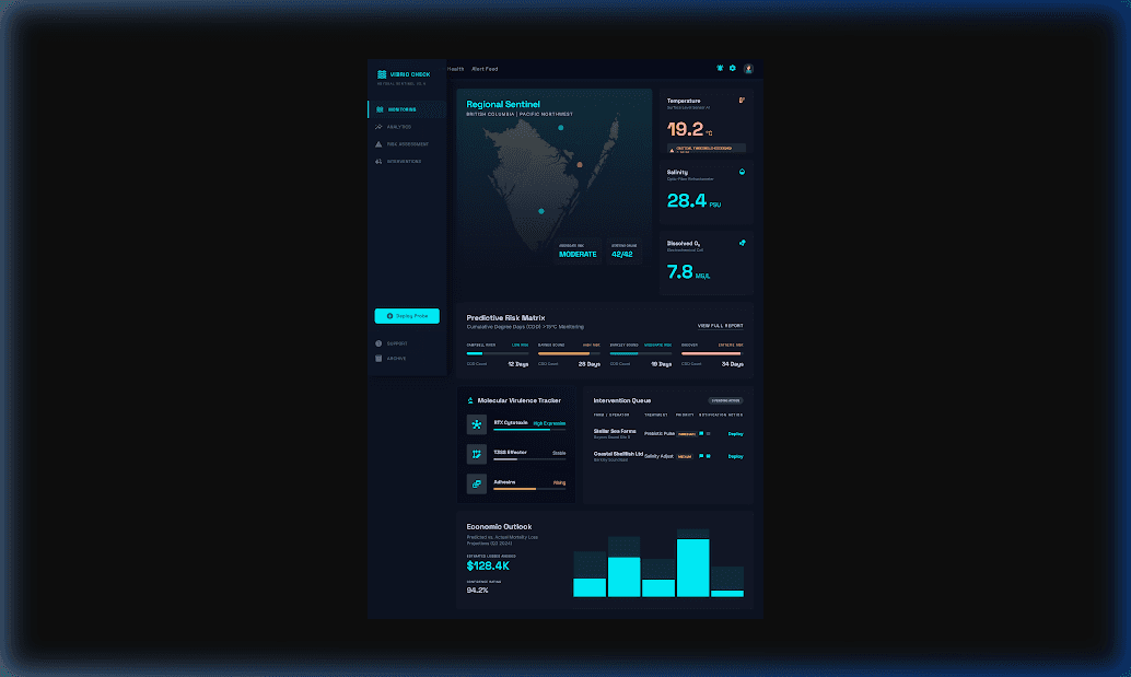
- Aragonite Saturation State (Ωarag): Quantifies localized ocean acidification stress and carbonate availability for juvenile shell calcification.
- Dissolved Oxygen & Hypoxia Thresholds: Real-time detection of benthic boundary layer hypoxia (< 2.5 mg/L) during summer stratification and upwelling events.
- Pathogen Proliferation Index: Multi-variable risk modeling predicting bacterial blooms (Vibrio parahaemolyticus) to prevent seafood contamination.
Interactive Web Application
Live Monitoring Portal
Access the full production 3D interactive bathymetric viewer and station time-series graphs: