
Kaggle Research Dossier
Atlantis Pacific Ocean Telemetry & Benthic Benchmark
An open-access high-resolution coastal oceanographic time series dataset published on Kaggle by Coralfil Labs. Features 9,360 hourly sensor records across 6 Northeast Pacific monitoring stations spanning depths from 1 meter to 215 meters seabed nodes, establishing a 72-hour ahead joint forecasting benchmark for acute hypoxia and corrosive aragonite dissolution.
Atlantis Pacific Ocean Telemetry: Benthic Boundary Layer Dynamics & Multi-Depth Hazard Forecasting in the Salish Sea
Provides calibrated multi-depth physical and biogeochemical time series across the Northeast Pacific, overcoming optical attenuation limits of surface satellites. Evaluates deep-learning hazard forecasting for acute subsurface hypoxia and shell-corrosive aragonite undersaturation under strict TEOS-10 physical invariants.
Key Methodological Innovations
- •Multi-depth in-situ sensor calibration from 1m surface buoys down to 215m benthic seafloor nodes
- •TEOS-10 thermodynamic density calculation enforcing physical conservation laws
- •72-hour ahead joint forecasting benchmark predicting acute hypoxia and corrosive shell dissolution
Competition Overview & Constraints
Official Benchmark URL: https://www.kaggle.com/datasets/coralfil/atlantis-pacific-ocean-telemetry
Timeline: Published Dataset & Live Benchmark
Team Role: Dataset Creator & Benchmark Host. Multi-depth in-situ oceanographic sensor array.
Overcoming Surface Satellite Attenuation in Coastal Basins
Optical satellites such as Sentinel-3 OLCI and SLSTR provide wide spatial coverage of sea surface temperature and chlorophyll-a, but cannot penetrate beyond the optical attenuation zone (typically 5 to 10 meters depth).
In coastal fjords, straits, and aquaculture zones across the Northeast Pacific, over 92% of acute biogeochemical hazards (such as severe hypoxia and corrosive aragonite dissolution) occur in the deeper benthic boundary layer. This dataset provides the physical in-situ measurements necessary to ground multi-modal models beneath the satellite blind spot.
Physical Invariants & TEOS-10 Thermodynamic Standards
All observations in the dataset are physically validated against thermodynamic conservation laws. Seawater density is computed using the International Thermodynamic Equation of Seawater 2010 (TEOS-10).
Aragonite saturation states (Omega_arag) are calculated from total scale pH, practical salinity, in-situ temperature, and carbonate ion equilibrium. Observations are cleaned through automated spike rejection and drift filtering via the Agent-Sea Ecco telemetry pipeline.
Verified Notebook Submissions & Evaluations
Atlantis-Pyramid & TimesFM 72-Hour Benthic Baseline
VerifiedKaggle Kernel: coralfil/atlantis-benthic-benchmark
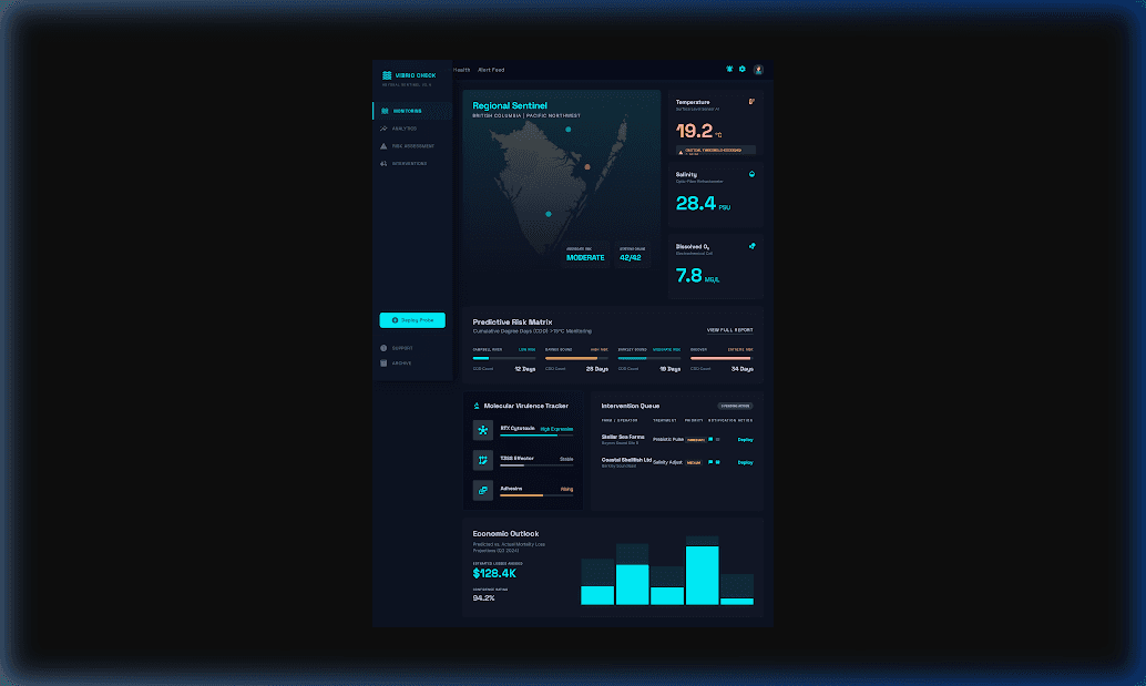
Calibrated in-situ time series covering water temperature, practical salinity, TEOS-10 thermodynamic density, dissolved oxygen, pH total scale, aragonite saturation, turbidity, chlorophyll-a, pathogen risk, and seabed boundary shear stress.